
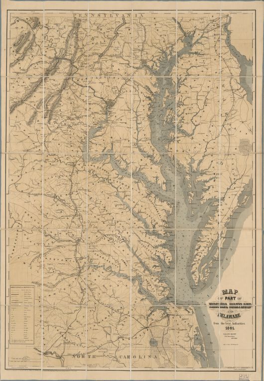
Familiar with its waters, I was delighted when an early chart of the Chesapeake Bay, entitled Map of part of Virginia, Maryland, and Delaware of 1861, appeared in my cataloging queue. But then who doesn’t like looking at old maps? Getting absorbed in what is fanciful, long-gone or merely changed, and finding remnants of the well-known from a long association with the landscape. And reading any map on paper doesn’t happen every day now, let alone a very rare one.
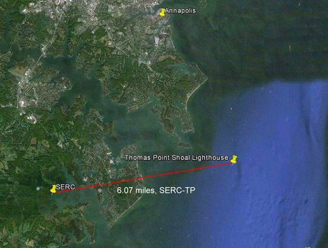
One detail stood out, being near my home port as well as the Smithsonian Environmental Research Center (SERC) on the West River in Edgewater, Maryland: the representation with a radiating star of a lighthouse on the shore of Thomas Point. Today this light is held aloft in the middle of the Bay on insect-like iron legs, four miles south from Annapolis. Until seeing this map, I never thought that it actually once stood on Thomas Point.

The largest estuary in the United States, the Chesapeake Bay extends about 200 miles between the states of Virginia and Maryland. Although it covers a huge area, with a complicated shoreline 11,684 miles long, the water is quite shallow with an average depth of just twenty-one feet. The deep, main shipping channel to the essential port of Baltimore handles a steady flow of massive container ships and freighters, but is kept open only by regular dredging. As portrayed in the 19th-century Map of part of Virginia, Maryland, and Delaware, this body of water was long important for trade and travel, servicing a large geographical region and acting as a highway for the rapidly developing nation.
A check of books on the Chesapeake Bay in the library of the National Museum of American History provided the history of the lighthouse. After many groundings and complaints, a lighthouse was built in 1825 on Thomas Point at the mouth of the South River (rebuilt in 1838) to warn of the long, treacherous sand bar reaching out from the western side of the Bay, squeezing deep-draft vessels close to the Chesapeake’s Eastern Shore. However, the land-based structure had a problem: the shoal that the light was warning about extended a mile and a half out into the Bay. Ships continued to run aground, so the United States Congress appropriated more money for the construction of a new lighthouse to be located at the end of shoal out in the water. The new light began its duties on November 20, 1875.
Thomas Point Shoal Lighthouse (its full name) is a classic screw-pile light, the only one still working and in its original location on the Chesapeake Bay (there is one other on Mobile Bay, Alabama—the Middle Bay Lighthouse—also in its initial position). As a native New Englander, I first found this regional design startling, not at all like the tall, white-washed granite, romantic beacons on rocky coasts I loved. The two-story, hexagonal building, just forty-three feet above mean high-water, topped by a light, is unique to the Chesapeake and southern sounds, especially in North Carolina, regions characterized by shallow water and muddy bottoms. To me, Thomas Point looks like a prim house from a cottage garden somehow set adrift.

The construction of this type of lighthouse has a series of metal pilings literally screwed into the bottom to serve as the foundation. Thirty-five feet in diameter, “TP” as Chesapeake sailors like to call it, contains, for the light keepers, a kitchen, sitting and storage areas, and a radio room on the first floor, and on the second, two bedrooms. It is topped by the light chamber and a red tinned roof. Illumination was originally by a fourth-order Fresnel lens (long since replaced by a modern plastic lens). It was the last lighthouse on the Chesapeake to be automated, its final keeper packing up and leaving in 1986.
Pressured to save costs, the Coast Guard planned to tear down the charming old lighthouse and replace it with a graceless, purely utilitarian steel tower, an aid to navigation. After a public outcry, the city of Annapolis stepped in and volunteers began to fix up the long-neglected structure. Thomas Point light was saved from destruction and shines on today, a beloved symbol of the State of Maryland.
There have been different proposals to maintain the structure — not an inexpensive undertaking. The Smithsonian Environmental Research Center briefly considered using it as part of its educational programs. It is now owned by a consortium of the city of Annapolis, Anne Arundel County, the Annapolis Maritime Museum, and the Chesapeake Chapter of the U.S. Lighthouse Society. It is also listed on the National Register of Historic Places and designated a National Historic Landmark. The Coast Guard owns and maintains the light and a foghorn, and the hard work of restoring and maintaining the old cast iron and wood structure is borne by a dedicated group of volunteers.

During the 19th century, there were seventy-five lighthouses in the Chesapeake showing the way. As seen in the Dibner Library’s Map of part of Virginia, Maryland, and Delaware, the Bay was an area of lively commerce. But this is a general map of the region created during the Civil War and portrays cities and towns, boundaries of states, railroads, roads, canals, forts, and soundings (for depth), covering not only the Chesapeake Bay but also the entire watershed area including Washington, D.C. In the year 1861, this was all-important information: the capital of the Union and the capital of the Confederacy (Richmond on the James River), were a mere 100 miles apart and both on rivers that feed directly into the Bay. The cover title on the original binding is Map of the seat of war, an indication of the intent of the strategic locations shown within. It is listed in the seminal Civil War Maps: an annotated list of maps and atlases in map collections of the Library of Congress. It was essential for the Federal Government to control the Bay, to protect waterways and cities for the safe and rapid transport of supplies and troops. Rebel spies and blockade runners lurked in the snug harbors and isolated streams but the Potomac Flotilla, created by the Government in the same year as our map, kept the Confederate Navy from its waters, completely securing the Bay by 1864.
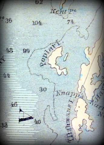

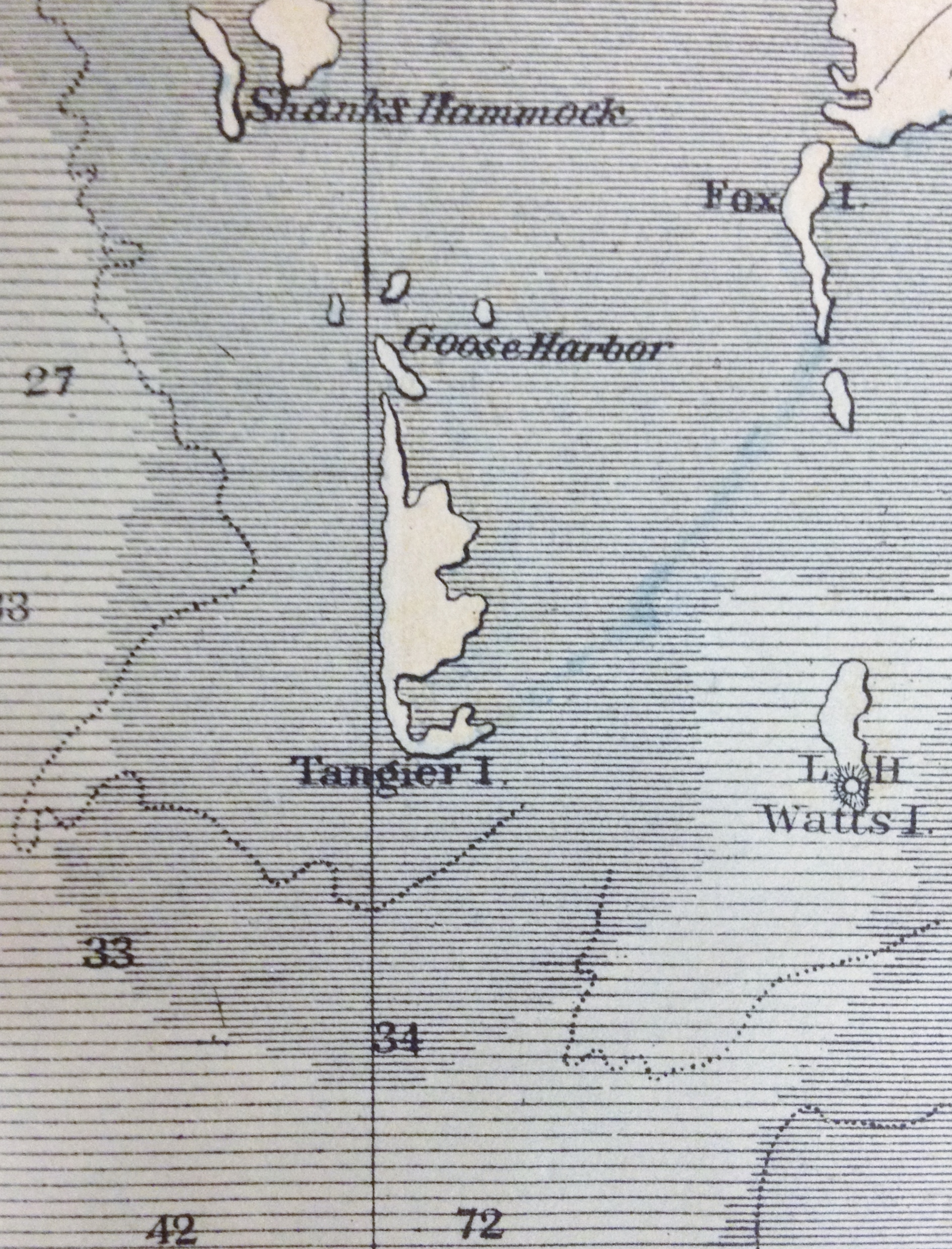
Apart from topographical and maritime sites that played into military strategy, what else can this map tell us today? It is a guide and baseline to a shifting environment. For example, there is Poplar Island in Maryland, long-abandoned and once rapidly disappearing. It is now being rebuilt with dredge spoil from the Baltimore shipping channel and harbor and is a huge environmental success story, nurturing an explosion of nesting diamond-back terrapins and waterfowl. Also delineated is a then-robust Tangier Island in Virginia. Today Tangier is rapidly eroding and threatened by ever-rising water levels, its historic and tight-knit community on track to possibly become one of the first in the United States lost to climate change.
Much reduced from the representations on our 1861 map, there are today twenty-three active lighthouses on the Chesapeake Bay. But even with all the modern, electronic navigation systems available to boaters, lighthouses and aids of navigation still play a crucial role. They also serve as guide posts to the past, reference points for the collection of maritime specimens and, as with Thomas Point Shoal Lighthouse, beautiful, unmistakable and historic waypoints.

National Lighthouse Day is August 7th. Thomas Point Shoal Lighthouse, with the possible exception of the Smithsonian’s Tropical Research Center in Panama, is the nearest lighthouse to a Smithsonian library—at SERC. Celebrate a lighthouse near you.

Notes:
All photographs by Stephen Blakely unless otherwise noted. Photographs of the Dibner’s copy of the map by the author.
Real time and archived weather at the lighthouse is online at the National Oceanic and Atmospheric Administration’s National Data Buoy Center at Thomas Point.
Holland, F. Ross. Maryland lighthouses of the Chesapeake Bay. 1997.
The Lighthouse Preservation Society.
Huntingfield Map Collection. Maryland State Archives.
Stephenson, Richard W. Civil War maps: an annotated list of maps and atlases in the Library of Congress (2nd edition, 1989), item numbers 13.4, 13.5, 13.6.
Turbyville, Linda. Bay beacons: lighthouses of the Chesapeake Bay. 1995.

One Comment
Thank you!
This was an unexpected treat.
I was doing research on my great g’father who was on blockade duty here in 1861-2.